|
|
PARCEL MAP NO.
NP2007-016 (PA2007-143) |
||
|
PLANNING
DEPARTMENT (949)
644-3200 FAX (949) 644-3229 |
|
|
|
|
|
|||
|
|
|||
|
|
|
|
|

|
Application No. |
Parcel Map No. NP2007-016 (PA2007-143) |
|
Applicant |
Ocean Group LLC |
|
Site Address |
514 Narcissus Avenue |
|
Legal Description |
Lot 16, and northeasterly 15 feet of Lot 14, Block
541,Tract 186 |
|
On August 6, 2007,
the Zoning Administrator approved the application request to combine a
lot and portion of a lot to create one parcel for two-unit condominium
purposes. The original single-family structure was demolished and a new
duplex is currently under construction. No exceptions to the development
standards of Title 19 are proposed with this project.
The property is located in the R-2 District. The Zoning
Administrator’s approval is based on the following findings and subject to
the following conditions. |
|
FINDINGS
The Zoning Administrator
determined in this case that the proposed parcel map is consistent with the
legislative intent of Title 20 of the Newport Beach Municipal Code and is
approved based on the following findings per Section 19.12.070 of Title 19:
1.
The existing single-family residence has been demolished and a new
duplex is currently under construction. Approval of the proposed parcel map
will combine a lot and portion of a lot to create one parcel for a two-unit
condominium conversion of the new duplex. The proposed subdivision and improvements
are consistent with the density of the R-2 Zoning District and the current
General Plan Land Use Designation “Two-Unit Residential”.
2.
The lot is regular in shape and has very little slope which indicates
that the site is suitable for development.
3.
This project has
been reviewed, and it has been determined that it is categorically exempt from
the requirements of the California Environmental Quality Act under Class 5
(Minor Alterations in Land Use Limitations) and Class 15 (Minor Land
Divisions).
4.
The proposed parcel map is for residential condominium purposes. All
Building, Public Works, and Fire codes will be complied with in the
construction of the proposed structure. Public
improvements will be required of the developer per Section 19.28.010 of the
Municipal Code and Section 66411 of the Subdivision Map Act. All ordinances of
the City and all Conditions of Approval will be complied with.
5.
The design of
the subdivision will not conflict with any easements acquired by the
public-at-large for access through or use of the property within the proposed
subdivision. Currently, there are no public easements located on the property.
6.
The property is
not subject to the Williamson Act since its use is not agricultural.
7.
The property is
not located within the boundaries of a specific plan and is not subject to any
specific plan regulations.
8.
The proposed
subdivision and improvements are subject to Title 24 of the California Building
Code that requires new construction to meet minimum heating and cooling
efficiency standards depending on location and climate. The Newport Beach
Building Department enforces Title 24 compliance through the plan check and
inspection process.
9.
The proposed
subdivision is consistent with Section 66412.3 of the Subdivision Map Act and
Section 65584 of California Government Code regarding the City’s share of the
regional housing need. The residential density on the site will increase from
one residential unit to two residential units. No affordable housing units are
being eliminated based upon the fact that the existing single family residence
was not occupied by a low or moderate income household and construction of the
new duplex will increase the residential units on the site from one to two
units.
10.
Wastewater
discharge into the existing sewer system will be consistent with the previous
single-family residential use of the property, which does not violate Regional
Water Quality Control Board (RWQCB) requirements.
11.
The site of the proposed parcel map
does not lie within the Coastal Zone and is therefore not subject to the
regulations of the certified Local Coastal Program.
CONDITIONS
1.
A parcel map
shall be recorded. The map shall be prepared on the
2.
Prior to
recordation of the parcel map, the surveyor/engineer preparing the map shall
tie the boundary of the map into the Horizontal Control System established by
the County Surveyor in a manner described in Section s 7-9-330 and 7-9-337 of
the Orange County Subdivision Code and Orange County Subdivision Manual,
Subarticle 18. Monuments (one inch iron pipe with tag) shall be set on each
lot corner, unless otherwise approved by the Subdivision Engineer.
Monuments shall be protected in place if installed prior to completion of
construction project.
3.
All improvements
shall be constructed as required by Ordinance and the Public Works Department.
4.
All existing
drainage facilities in the public right-of-way, including the existing curb
drains along
5.
All above ground
improvements shall maintain the minimum 5-foot alley setback at the rear
property line.
6.
7.
All existing
private, non-standard improvements within the public right-of-way and/or
extensions of private, non-standard improvements into the public right-of-way
fronting the development site shall be removed.
8.
Install new sod
or low ground covers of the type approved by the City throughout the
9.
Per Chapter 13
of the City Municipal Code, two street trees shall be planted along the
10.
All applicable
Public Works Department plan check fees, park dedication fees, improvement
bonds and inspection fees shall be paid prior to processing of the map by the
Public Works Department.
11.
Arrangements
shall be made with the Public Works Department in order to guarantee
satisfactory completion of the public improvements if it is desired to record a
parcel map or obtain a building permit prior to completion of the public
improvements.
12.
Each dwelling
unit shall be served with an individual water service and sewer lateral
connection to the public water and sewer systems, unless otherwise approved by
the Public Works Department and the Building Department.
13.
Each unit shall
be connected to its individual water meter and sewer lateral and cleanout in
the alley. Each water meter and sewer cleanout shall be installed with a traffic-grade
box/frame and cover.
14.
Each dwelling
unit shall be served with individual gas and electrical service connection and
shall maintain separate meters for the utilities.
15.
Overhead
utilities serving the site shall be undergrounded to the nearest appropriate
pole in accordance with Section 19.28.090 of the Municipal Code unless it is
determined by the City Engineer that such undergrounding is unreasonable or
impractical.
16.
Additional Public
Works improvements, including street and alley reconstruction work may be
required at the discretion of the Public Works Inspector.
17.
If any of the
existing public improvements surrounding the site is damaged by the private
work, public works improvements including, but not limited to, curb and gutter,
sidewalk, and alley/street reconstruction may be required at the discretion of
the Public Works Inspector.
18.
All work
conducted within the public right-of-way shall be approved under an
encroachment permit issued by the Public Works Department.
19.
An encroachment
agreement shall be applied for and approved by the Public Works Department for
all non-standard private improvements within the public right-of-way.
20.
Disruption
caused by construction work along roadways and by movement of construction
vehicles shall be minimized by proper use of traffic control equipment and
flagmen. Traffic control and transportation of equipment and materials shall be
conducted in accordance with state and local requirements.
21.
All vehicular
access to the property shall be from the adjacent alley, unless otherwise
approved by the City Council.
22.
In compliance
with the requirements of Chapter 9.04, Section 901.4.4, of the Newport Beach
Municipal Code, approved street numbers or addresses shall be placed on all new
and existing buildings in such a location that is plainly visible and legible
from the street or road fronting the subject property. Said numbers shall be of
non-combustible materials, shall contrast with the background and shall be
either internally or externally illuminated to be visible at night. Numbers
shall be no less than four inches in height with a one-inch wide stroke. The
23.
County
Sanitation District fees shall be paid prior to issuance of any building
permits, if required by the Public Works Department or the Building Department.
24.
Prior to
recordation of the parcel map, park dedication fees for one
dwelling unit shall be paid in accordance with Chapter 19.52 of the Newport
Beach Municipal Code. This fee shall be paid at the time the map is submitted
to the Public Works department for plan check, unless evidence from a competent
authority with regard to the existence of two dwelling units is provided to the
Planning Department.
25.
Subsequent to
recordation of the parcel map, the applicant shall apply for a building permit
for description change of the subject project developments from “duplex” to
“condominium.” The development will not be condominiums until this permit is
finaled.
26.
This parcel map
shall expire if the map has not been recorded within 3 years of the date of
approval, unless an extension is granted by the
Appeal Period
The Zoning
Administrator’s decision may be appealed to the
By:
Zoning Administrator Javier S. Garcia,
AICP
JSG:ks
Attachments:
Vicinity Map
Appeared
in Opposition: None
Appeared in Support:
None
|
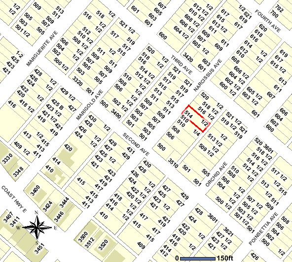
Parcel Map No. NP2007-016
PA2007-143
514 Narcissus Avenue